
Eaton Fire Aftermath
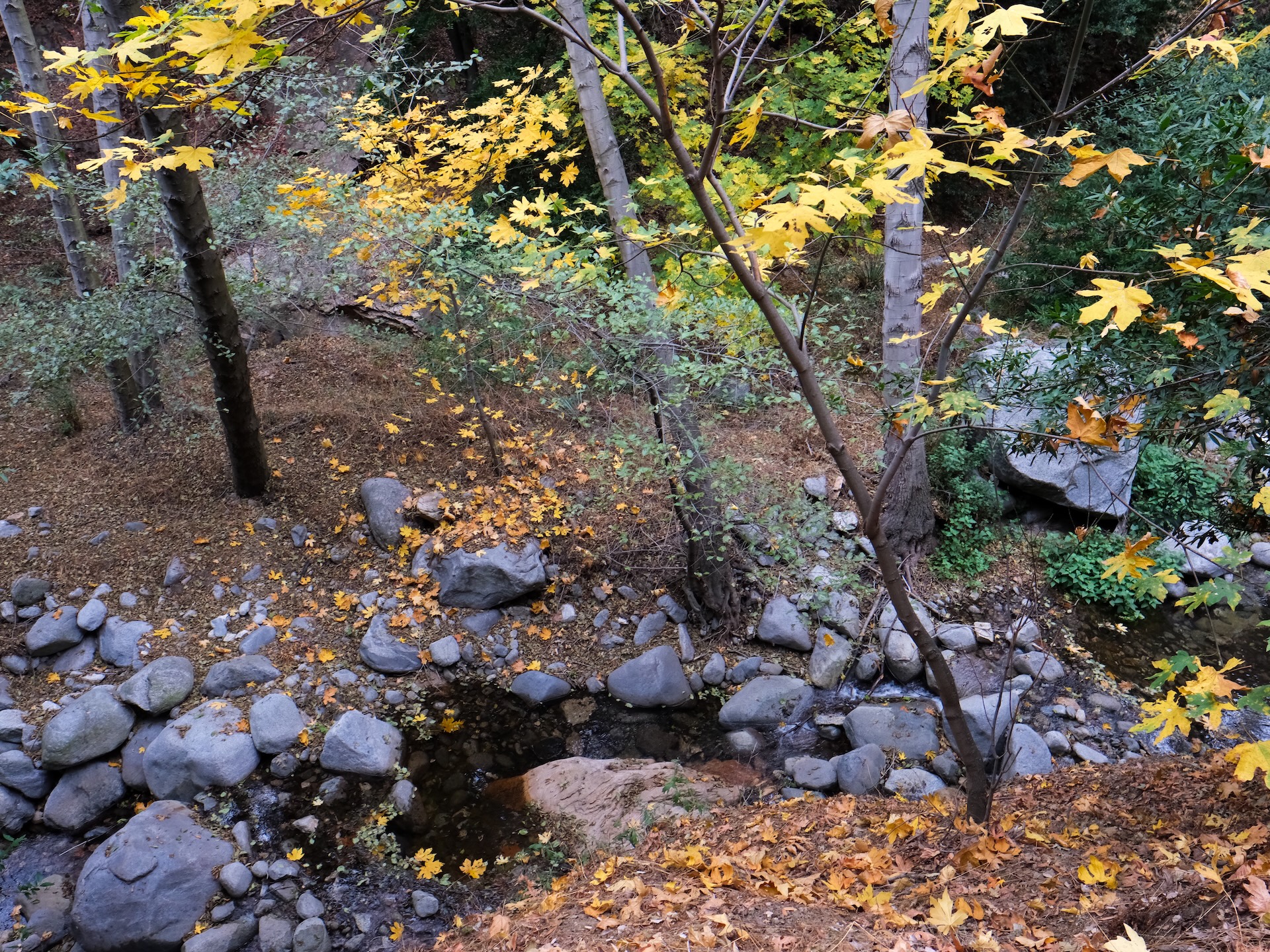
It has been over two months since the fire. I’m washing windows at a remodel / addition project I’m finishing up and realize that I’m cleaning ash trapped in the window sashes from the fire. Is this ash from the homes in my neighborhood? Is this ash from the chaparral gleaning the slopes of upper Eaton Canyon… Where my most sacred connection to the outdoors exists… Idlehour Trail in the majestic upper Eaton Canyon. “The backcountry of the frontcountry.” I have spent so many days alone on Idlehour working on the trail, soaking in the pools, or nerding out on plants and wildlife.
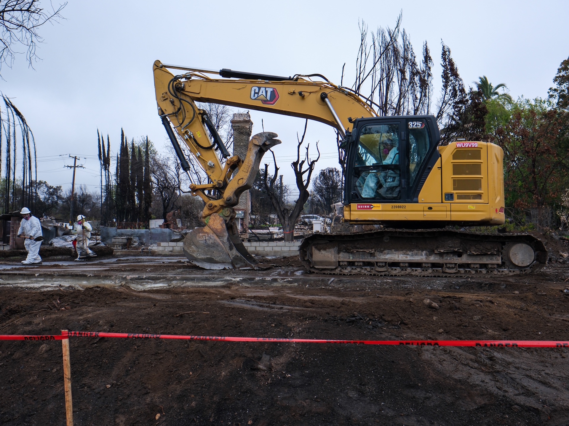
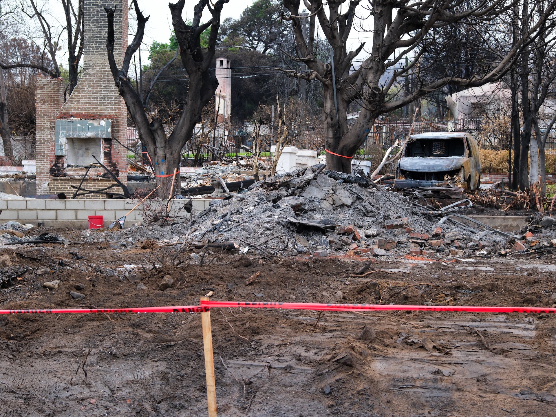
Sixty-six days after the Eaton Fire started, the United States Forest Service – Angeles National Forest granted us permission to enter the burn zone to begin assessments and planning for repairs. A couple winter storms have recently impacted the fire area, causing flash floods and debris flows that damaged foothill communities. Now it was time to see how bad the impacts were to the trails. Sixty-seven days after the fire, March 15th, ironically the same day the final remnants of our property in Altadena were being cleaned up and hauled away by the United States Army Corps of Engineers, friend and volunteer Eric Melanson and I set off to do a full assessment of Idlehour.
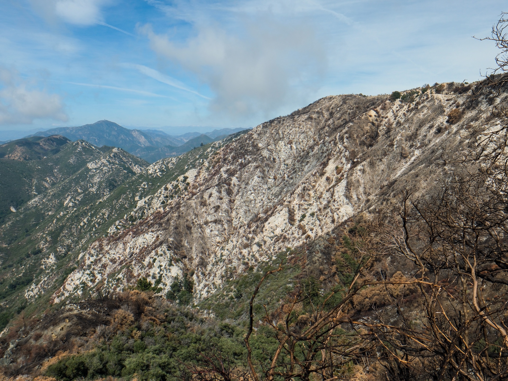
After poring over satellite imagery after the fire, we knew that it would not be a good situation in upper Eaton Canyon. Our plan was to get dropped off at Eaton Saddle and ride Mt Lowe Road, then through Idlehour to the Mt Wilson Toll Road, then on down into Altadena. Winter storms had brought a nice dusting of snow to the area. Our bikes floated across the snow that blanketed the road along the north aspect of Mt Lowe as we glided down from Markham Saddle. The fire did not cross to this side of the ridge. As we near the turnout for upper Bear Canyon, there’s a spot where the road passes the top of the ridge, creating a window into the Grand Canyon. We stopped and peered south into the burn for the first time up close.
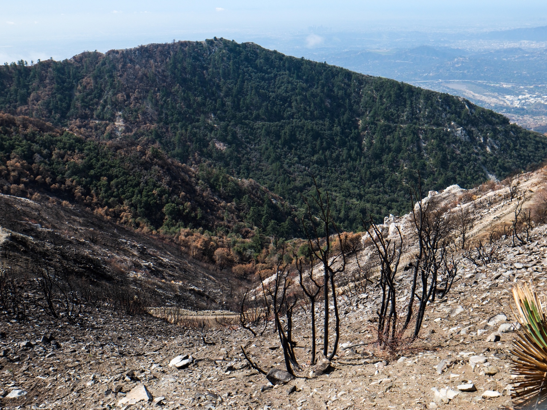
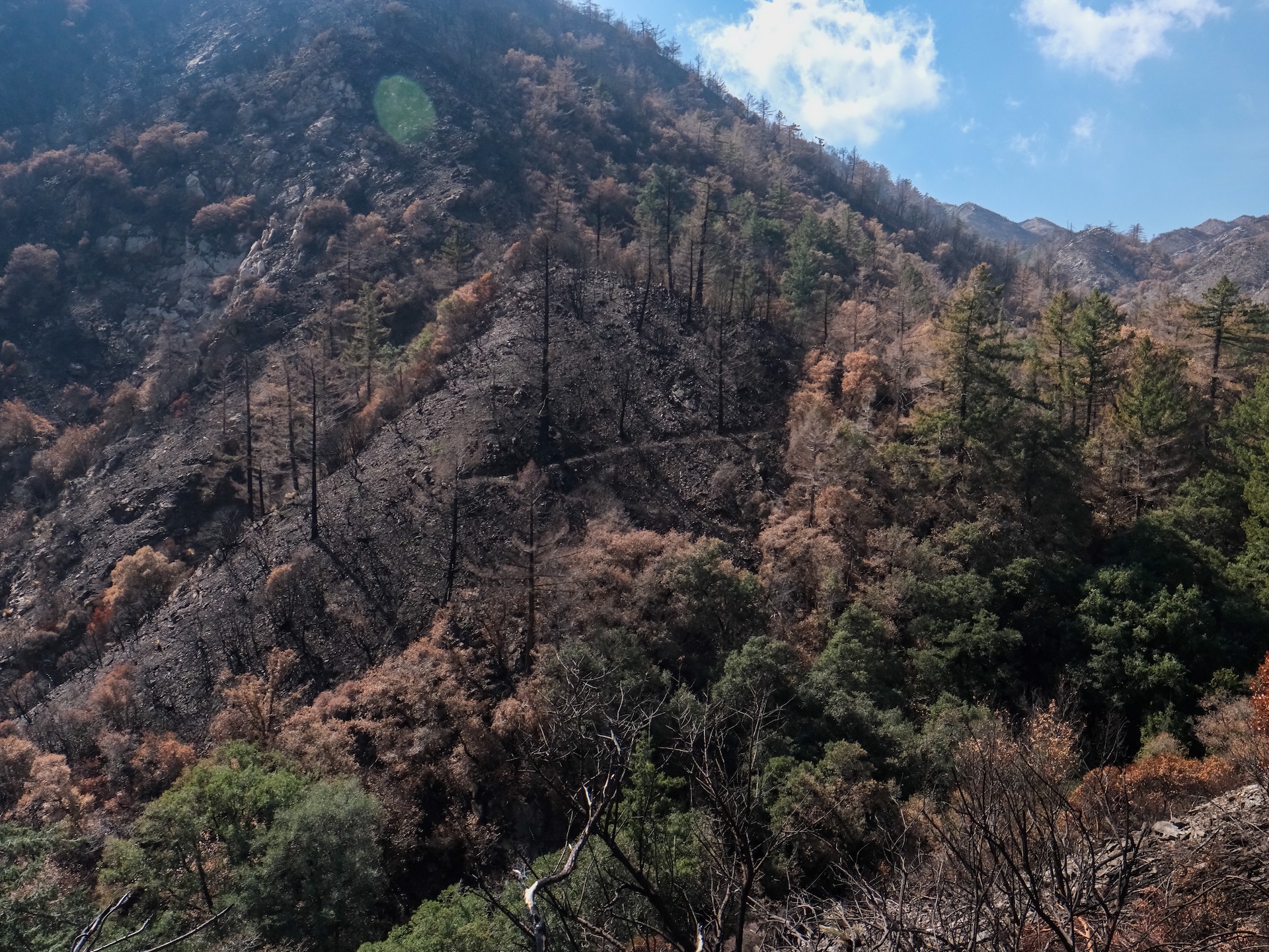
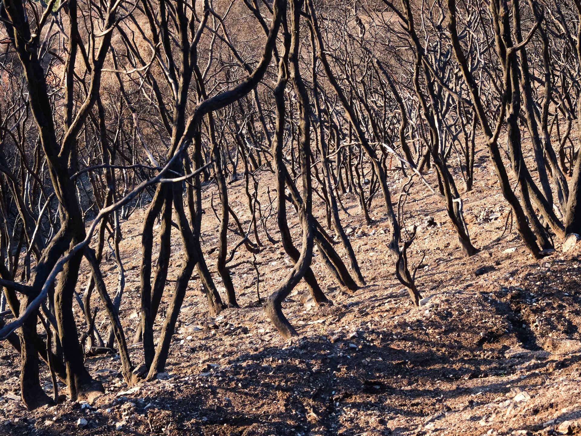
At first glance, you could tell Mt Lowe West and the upper half of Tom Sloane were completely burned over. It was nice to see the green along the upper north-facing stretch of Middle Sam Merrill as we peered into the Grand Canyon. A moment of relief washed over me seeing green on the second half of Tom Sloane all the way to the saddle. Within the green are beautiful rock staircases built by the recently passed away volunteer and master mason, the legendary Dave Baumgartner. Many areas in the green are still subject to erosion when there’s fire damage upslope.
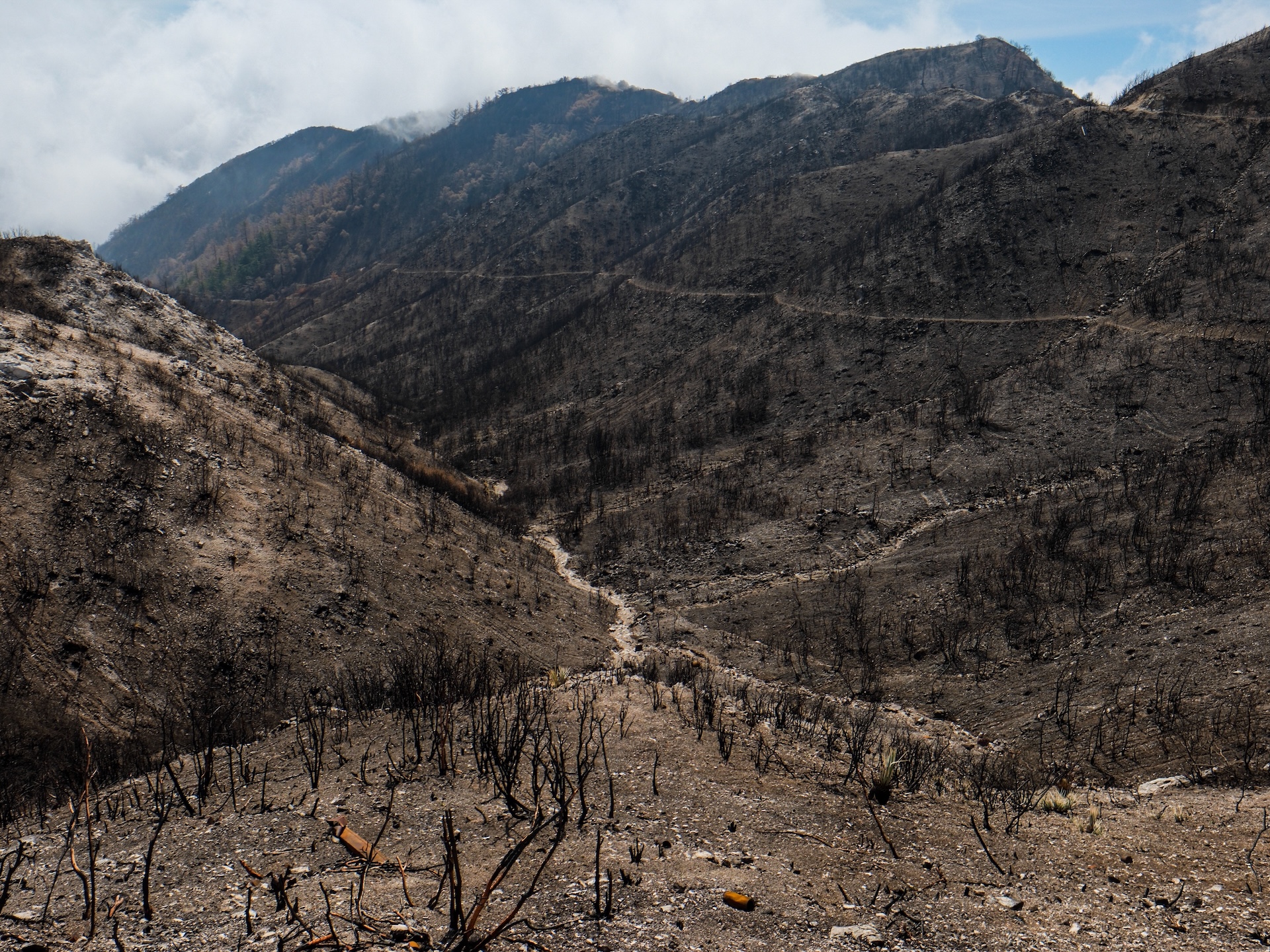
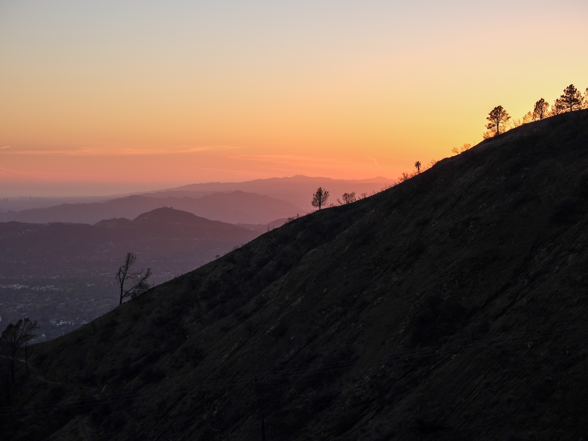
3,000 feet above Idlehour Trail Camp and the upper Eaton Canyon floor are the completely burned mountain slopes of Muir Peak (4,688’), Mount Lowe (5,606’), and Mount Wilson (5,713’). The gravity of the situation was beginning to set in. We rode past the Idlehour Trail junction and peered down into a 360-degree labyrinth of completely nude drainages all snaking their way into Eaton Canyon. We rode past to do a welfare check on the Mount Lowe Trail Camp. The drainage that passes through the entrance of the camp has erosion from flash flooding and debris flows. Not terrible. The fire scorched the trees around camp, but the camp is okay. It appears when the flames marched up Eaton and Rubio Canyons and over Muir Peak to the top of Idlehour, it then spread east and west across the south aspects of Mount Lowe but not passing over to the north side where our adventure began. When the fire passed over the campground, it did not travel downhill into the Grand Canyon. It spread to the west but primarily uphill, which is why it missed that second half of Tom Sloane. A relief.
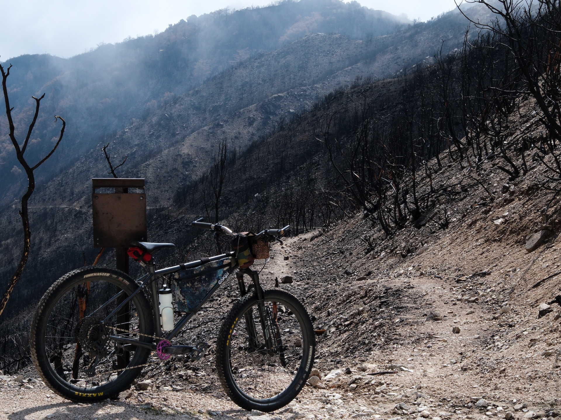
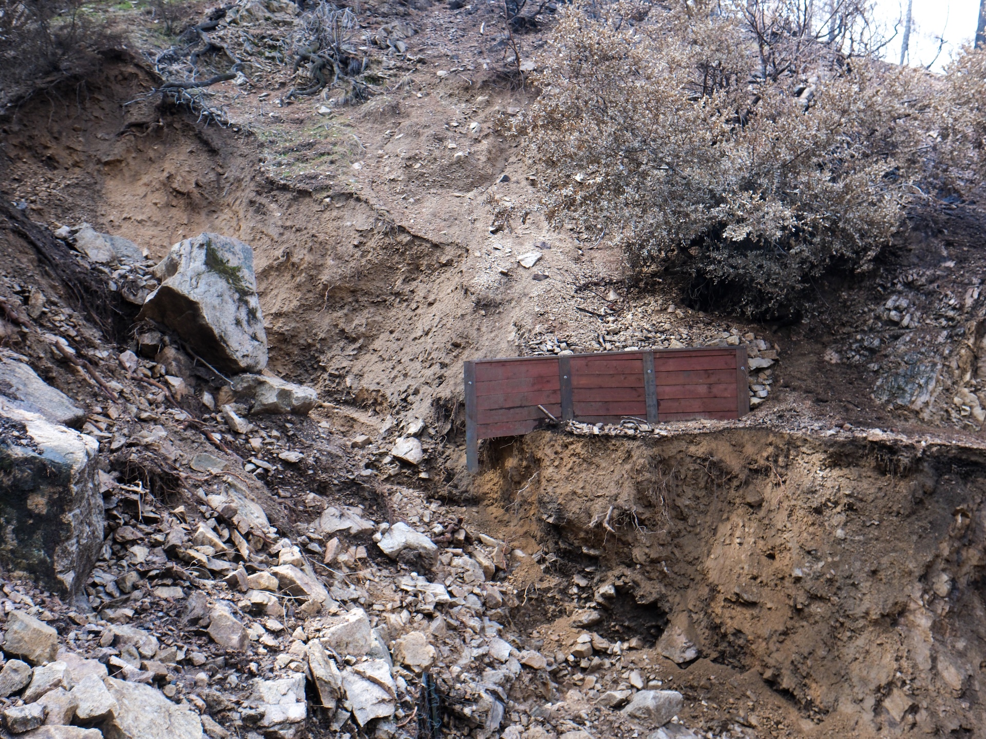
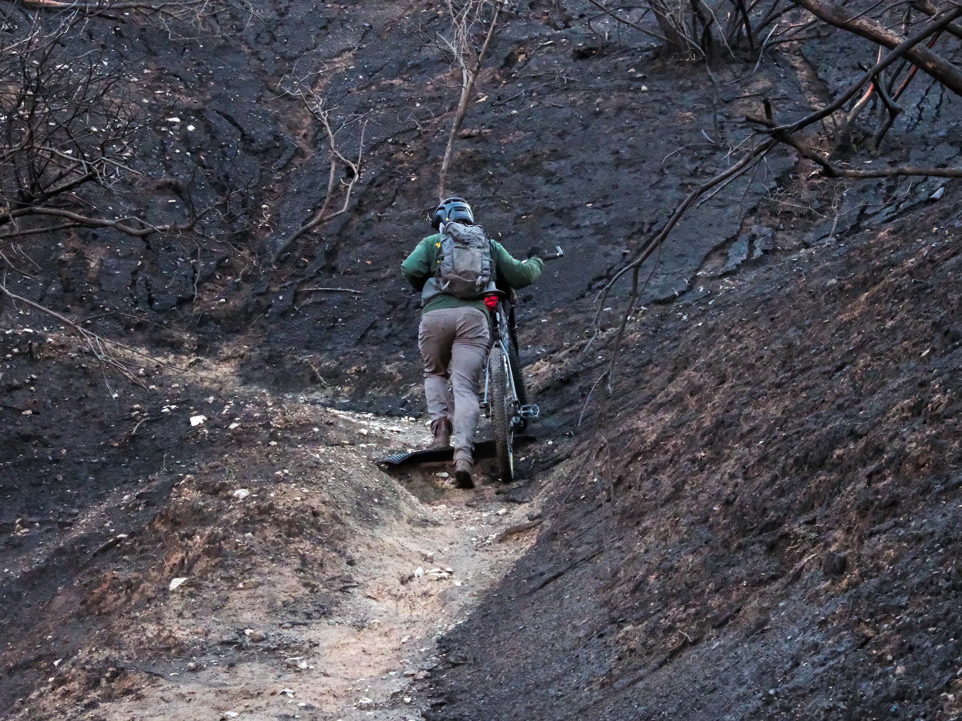
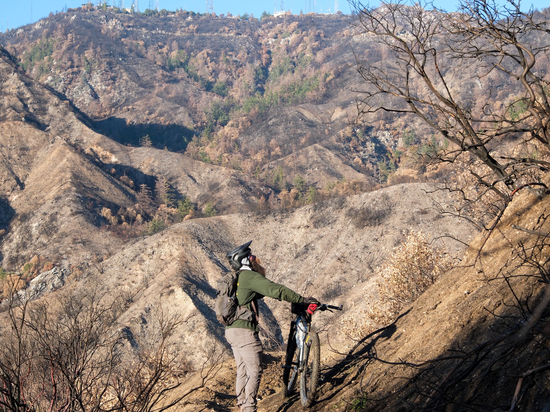
It was time to set off down Idlehour and use our custom survey app. We can quickly take a photo and quick assessment using our GIS tool that is publicly available on our website. “Quickly” is not the case when you have to survey every microdrainage because the damage to the trail is so widespread. When we reached our Sutter wall project from last spring, it was pretty upsetting to see the erosion that had taken place. The Sutter wall was intact, clinging to the edge of nothing and partially suspended in space. Eric hung from the top cap of the Sutter wall, and with his feet dangling a few feet above the scoured drainage below, he let go and dropped into the pit. I handed the bikes down to him, and we helped each other climb back out onto the trail on the other side. We encountered a few drainages that were extremely difficult to pass through. The intensity of the damage and how long of a day this was going to be had officially set in.
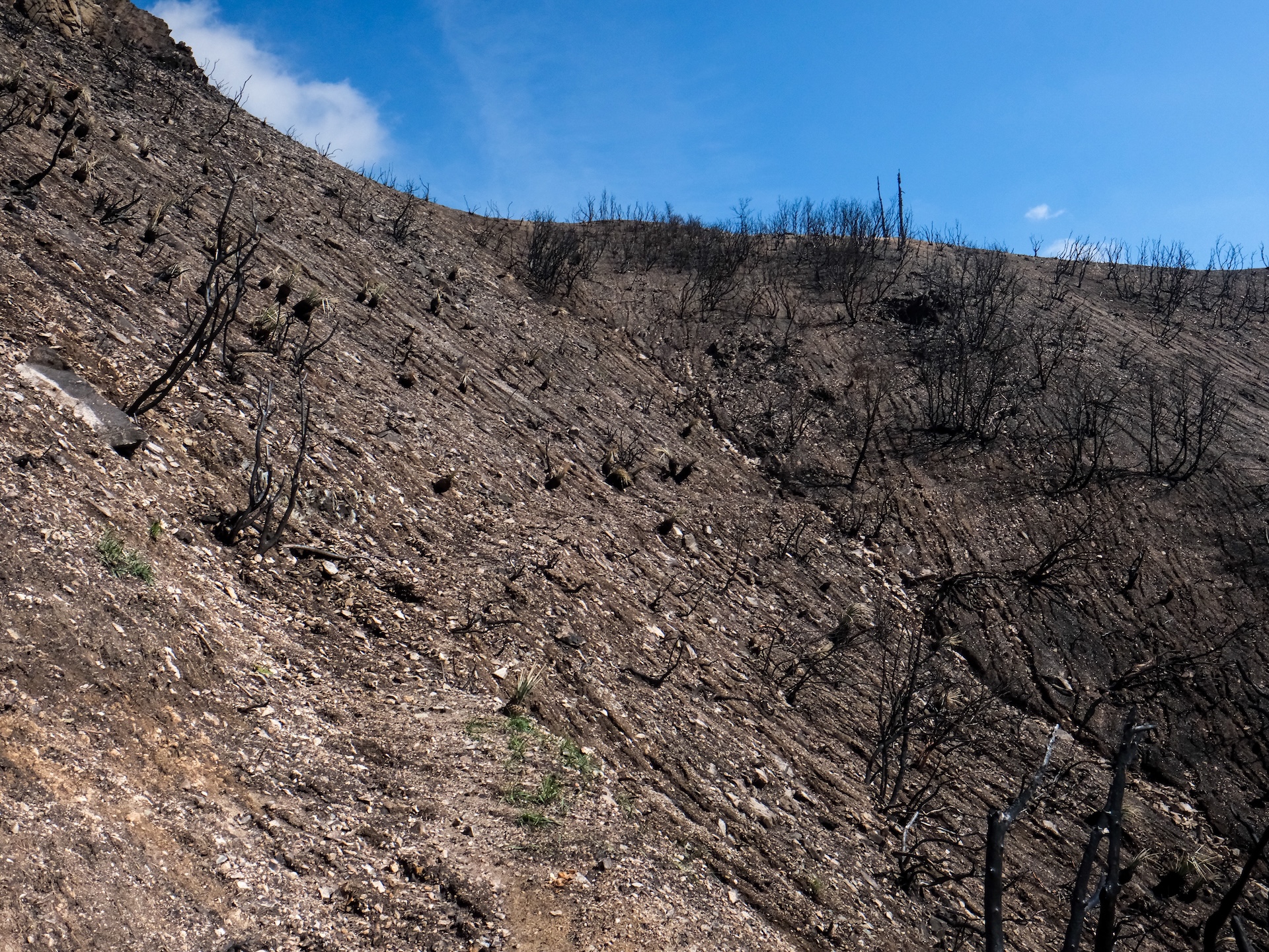
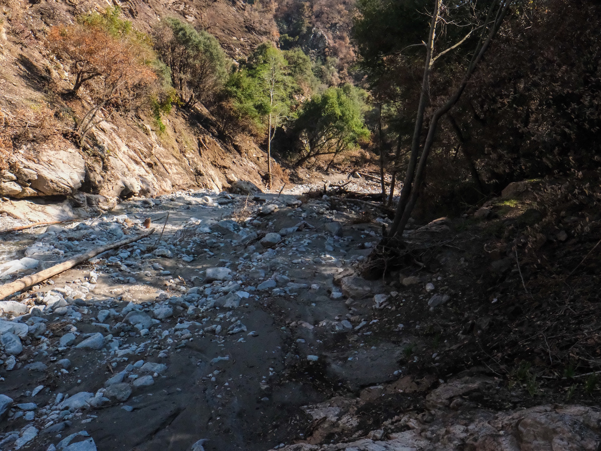
Nearing the first stream crossing we finally dipped into a pocket of green near the water. On the short climb after the stream crossing, the trail and surrounding area suffered extreme burn intensity. Only a couple burnt yucca stumps and blackened twigs remained. We switch-backed down the second descent to the old Yucca Flat campground on the upper Eaton Canyon floor. It had completely flooded over, and many of the trees were gone. It was a wide expanse of sediment and charred oaks, with some of the old rock features revealing where the path used to be. The level of erosion and damage to the creek area was sad to see.
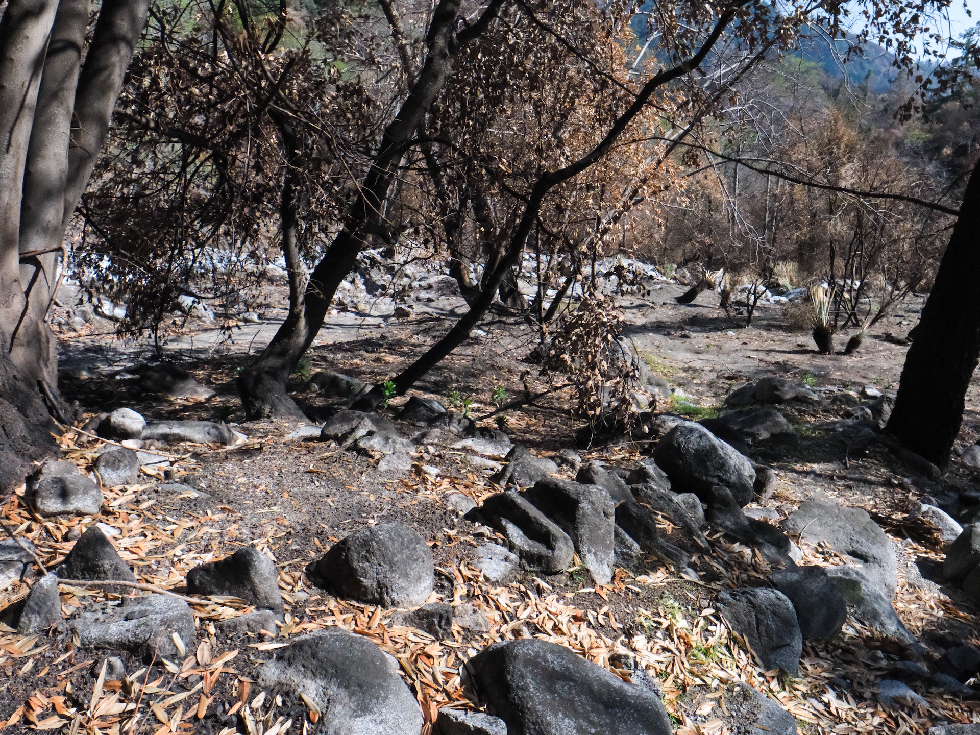
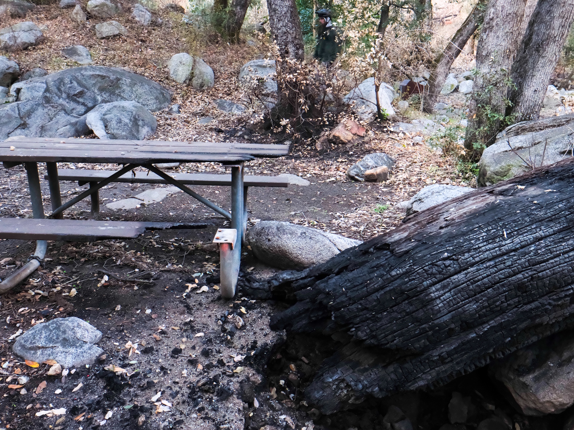
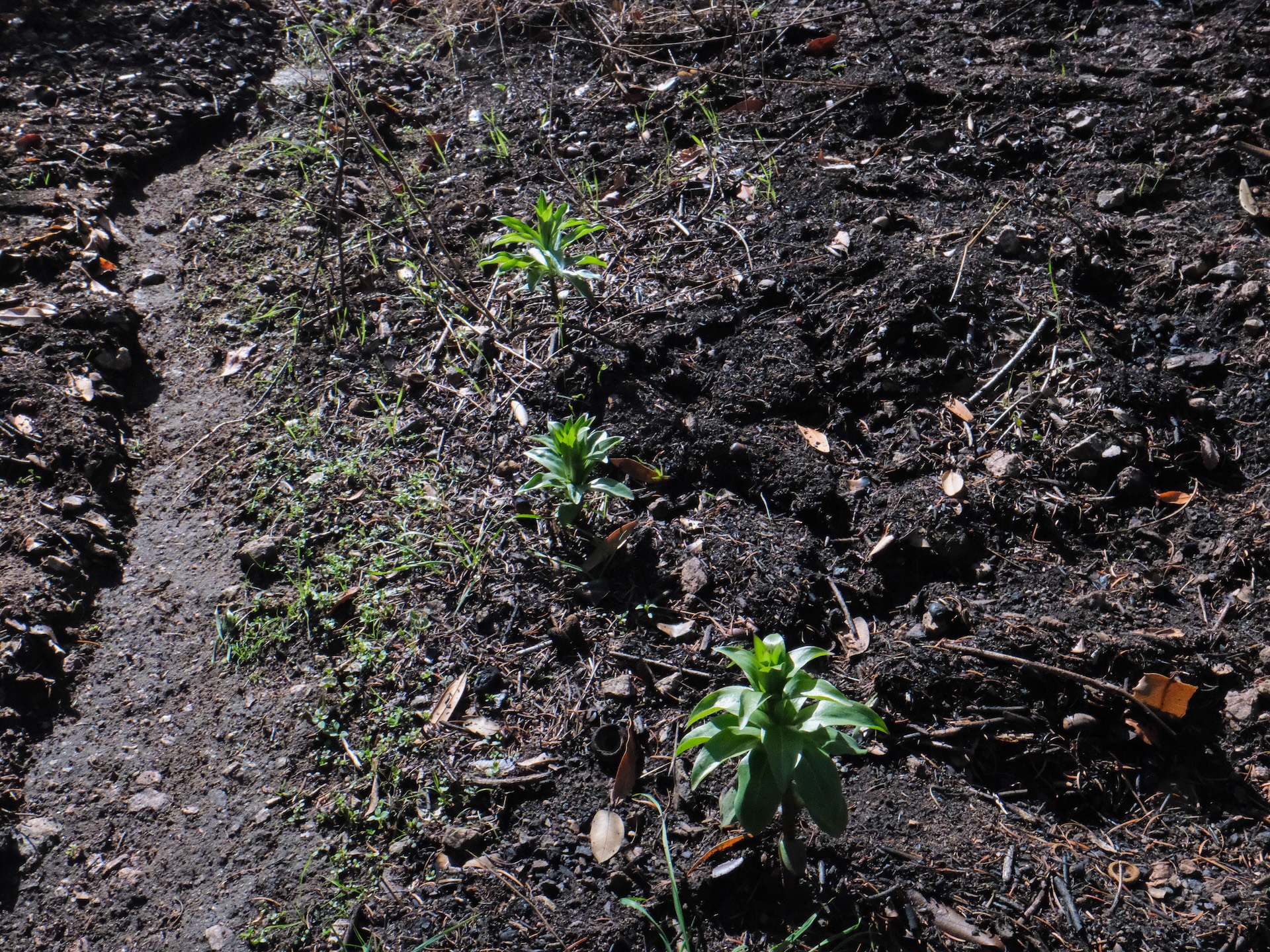
After navigating the obstacle course along the canyon bottom section of the trail, we finally made it into Idlehour Trail Camp. The floods came right up to camp and stopped just short of the first stove and bench. The high water line of debris lay in a soggy pile just outside the main camp. The overflow camping just upstream is all covered in sediment. Many of the alders and other trees growing by the creek are gone, ripped out of the earth by the floods. The sunlight invades the canyon calling out to post-wildfire botanicals to take up residency. Future storms are needed to flush out the debris clogging up the watershed.
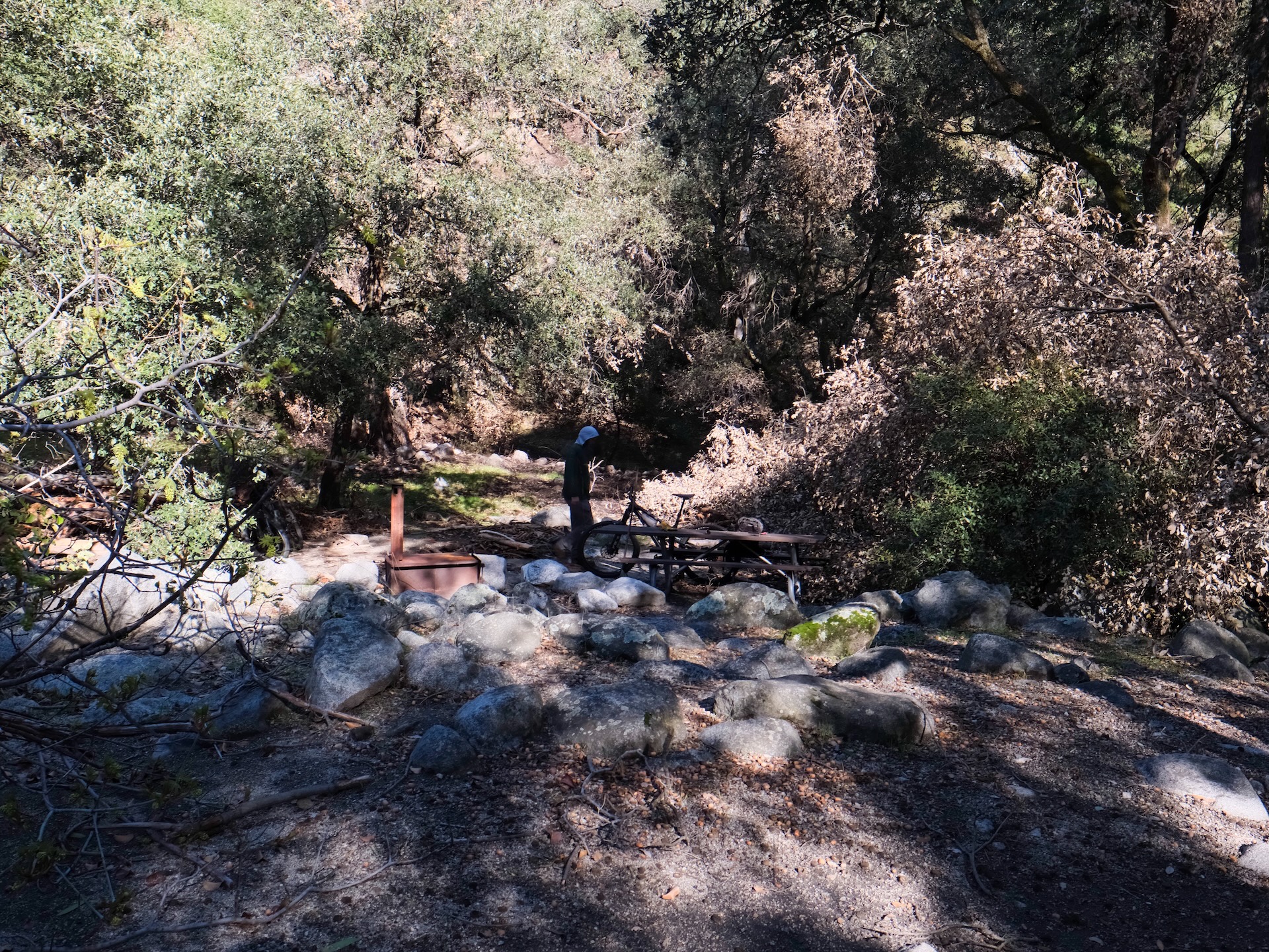
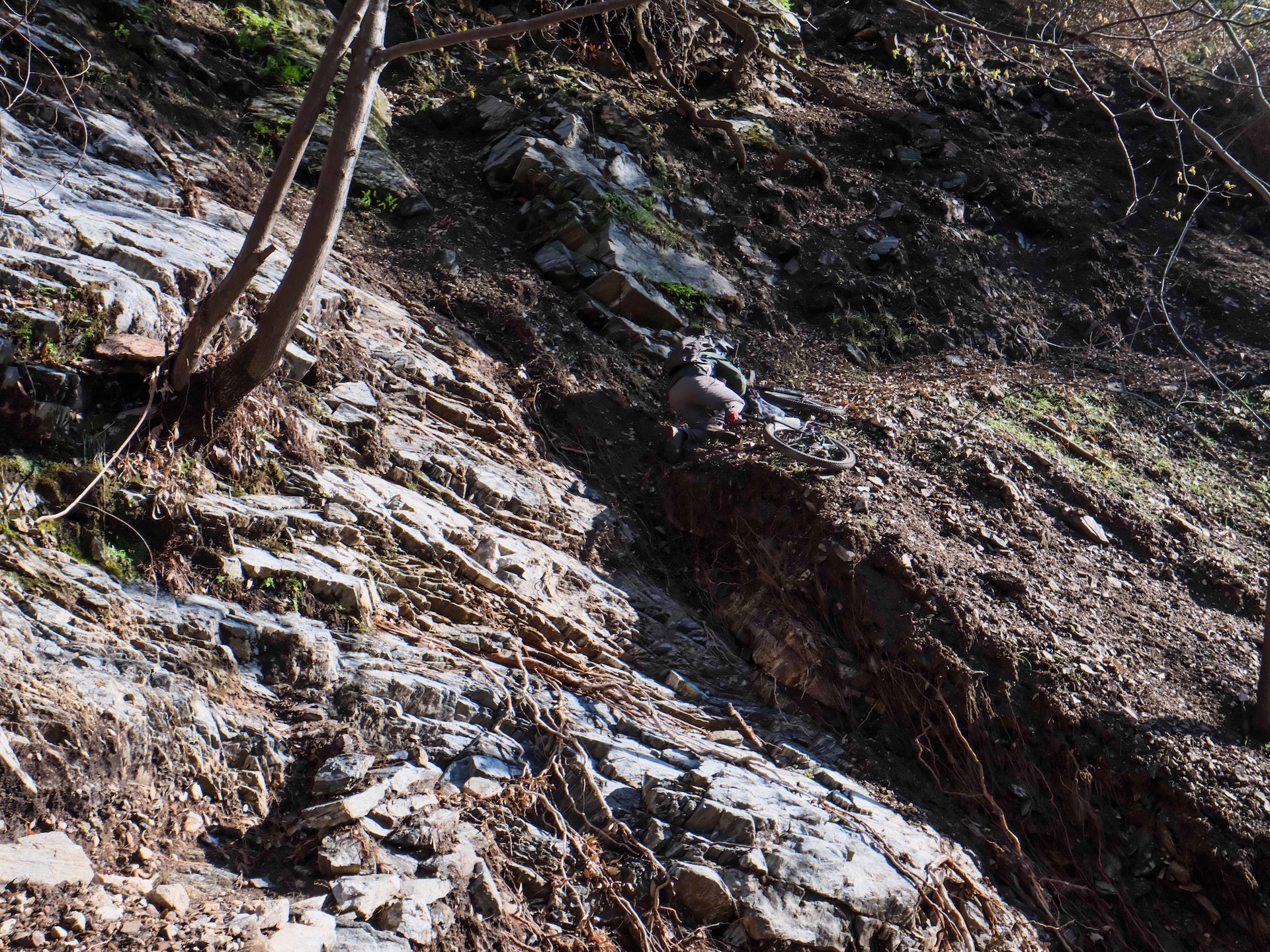
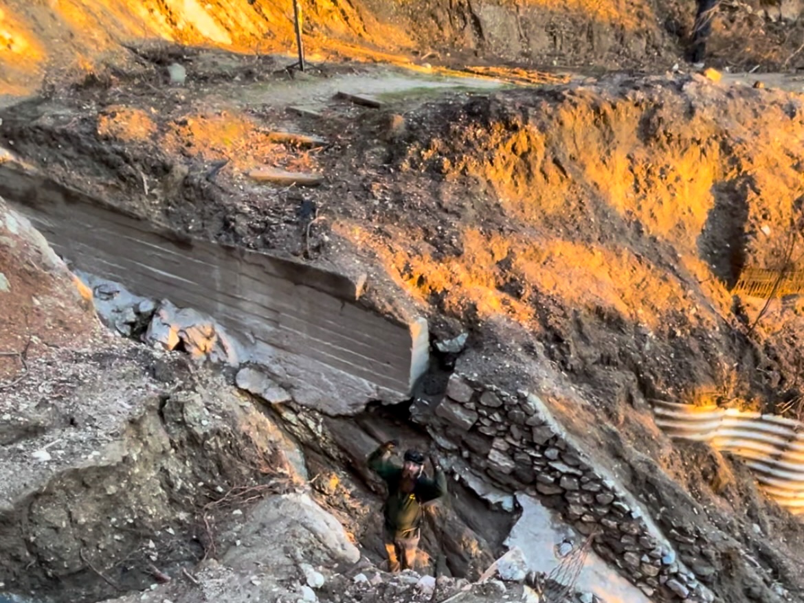
We had a snack at a campground bench then decided to make the final push up to Mt Wilson Toll Rd at 4:30pm. Immediately, we got hit with labor intensive tree-projects that needed work to be able to pass through. When the crown of an oak falls directly in the trail corridor with a steep sideslope, you’ve got no good option other than to get to work. It was 5:30 or 6:00pm and we were only about 1/10 of a mile from camp. Eventually we pushed our way to the top of the climb before the final descent to the Toll Rd. This area suffered extreme burn intensity. Not enough to destroy those pesky, outdated rubber water bars, though. I had a sinking feeling that the bridge over Esme Creek that connects Idlehour Trail to the Mt Wilson Toll Road would be gone. Sure enough, that was the case, including a big hunk of the trail on the shoulder of the drainage that the bridge clung to. The bridge could easily be down at the Eaton Canyon Reservoir.
We made it to Henninger at sundown. A sad sight in comparison to its former glory, but a shard of life reminds you of the resiliency of nature. It will be beautiful again. The future of LA County’s Henninger Flats was already uncertain, and now the facility is mostly burnt down and the road and car bridge destroyed.
As the sun went below the horizon, we hopped on our bikes for the final leg of our journey down to the Pinecrest Gate access point down in Altadena. This usually takes 10 or 15 minutes on a bike. Less than three miles and all downhill on a well-maintained dirt road. Not this time, and especially with night falling. Huge landslides blocking water flow on the road have made deep pools of ashy quicksand. Erosion has cut through the road as if the earth had opened up to swallow the landscape from below. The good news is that the United States Forest Service considers this a “necessary road for forest administration,” and they are in the very early stages of working with LA County Public Works and Parks & Rec to restore the area. However, they believe the bridge over Eaton Canyon was not built by them, and it remains a point of contention.
We are working with our partners at the Angeles National Forest to begin rebuilding trails in the Eaton Fire burn zone. We have a verbal confirmation of some initial funding through BAER (Burned Area Emergency Response). Funding comes as an emergency response to mitigate potential risks to resources on National Forest System lands. We will be doing preventative work to mitigate future erosion where these impacted drainages cross the trail. More specifically, we will be targeting Idlehour and Upper Sam Merrill to start. The funds are also being used for “BAER Road Stabilization” on the Mt Wilson Toll Road. The Angeles National Forest expects to have a contract awarded and moving dirt within 60-90 days. There is A LOT of work to do to make this area safe for the public to enter for volunteer work days. Please be patient while we navigate the early stages of planning for our restoration efforts.
*Impacted Forest Service System Trails: Idlehour, Upper Sam Merrill, Middle Sam Merrill, Lower Sam Merrill, Echo Mountain, Mt Lowe West, Tom Sloane, Sunset Ridge, Dawn Mine, and Mt Wilson.